We make maps to tell stories and today we start telling “Student stories” to share what is beyond. In this new post series, Cartography M.Sc. students tell their stories, e.g. about cartographic projects, internships, summer schools and conferences.
Cartography M.Sc. students Michael Hallett and Luke Harvey came up with a challenging idea for their Mapping project this winter semester – creating a 3D printed model of one of the most beautiful regions in Bavaria – Garmisch-Partenkirchen. Here is their story…
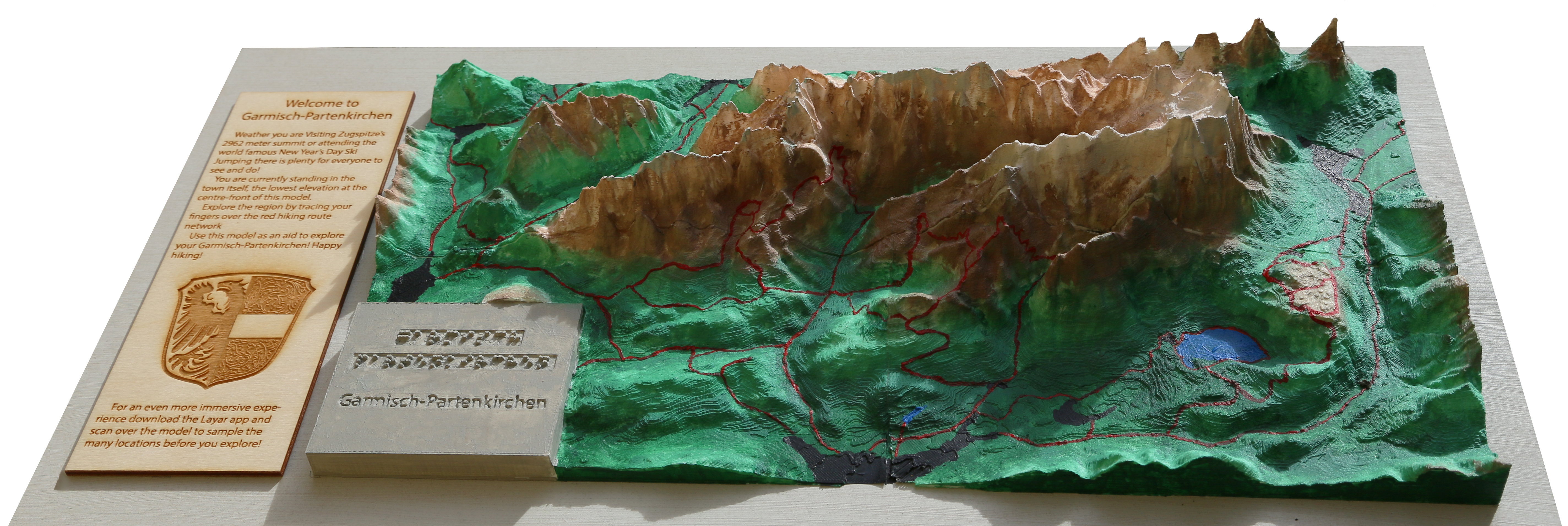
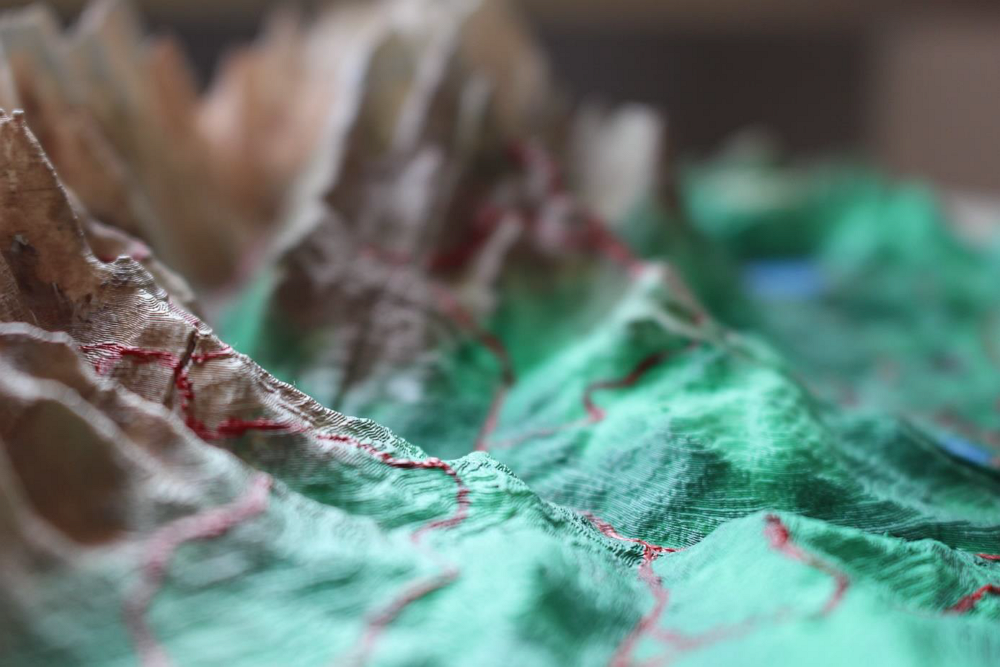
The inspiration for creating the model came from our hiking trips to Garmisch-Partenkirchen. The current 2D mapping boards were cluttered with too much information and made for difficult reading. We also felt that the boards didn’t effectively communicate how steep some of the gradients along the hiking routes were. As a team, we decided to try and improve the mapping of the hiking routes using a new approach by creating a model. As a result of this, we were also able to make the map tactile. This allowed us to make the model more accessible for everyone, particularly persons with visual impairments by including embossed hiking routes and braille text.
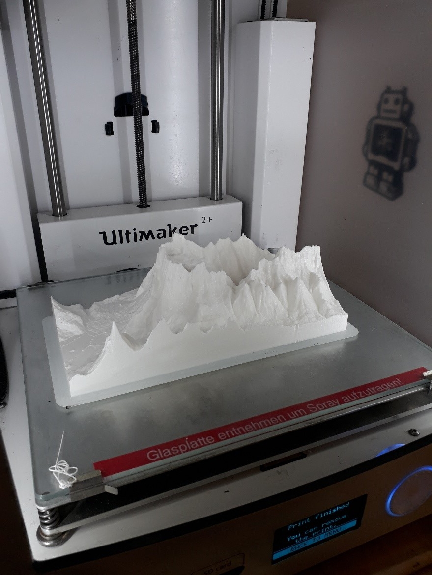
Going into this project neither of us had any knowledge about 3D printing. By making use of the TUM MakerSpace we were able to attend a free 3D printing workshop and use their facilities. The MakerSpace really opened our possibilities and made the whole project possible. Multiple trips to the MakerSpace were made and each time we would come back with a greater understanding of 3D printing and become more proficient and confident with the necessary software programmes. Eventually, we came back with a printed model we were proud of.
Neither of us considers ourselves artists but we decided to paint on the layer tints displaying relief. Everyone told us painting is meant to be therapeutic, but it was by far the most stressful part of the project!
On the more technical side, this class has developed our skills on multiple software programmes including Photoshop, Cura and Meshmixer.
We faced many hurdles while making this model and had to come up with different ways to overcome them. We struggled to find a method of embossing the hiking routes onto the model halting our progress until we discovered the tool while experimenting on Meshmixer. Another stumbling block we encountered concerned the size of the model. We initially wanted a considerably larger model but our inexperience in 3D printing hadn’t accounted for the print costs and the length of average print times. The dimensions of the printer also made us reconsider the size of the model. To overcome these issues, we opted to make a smaller model comprising of four segments which felt like a fair compromise balancing the cost, quality and size of the model.
3D printing wasn’t a skill we expecting to learn but it has introduced us to a fun and unique method of mapping which we will take forward into the future. We are proud of the final output and hopefully, it allows a more inclusive hiking environment in Garmisch-Partenkirchen.
Michael Hallett & Luke Harvey, WS 2018/2019


