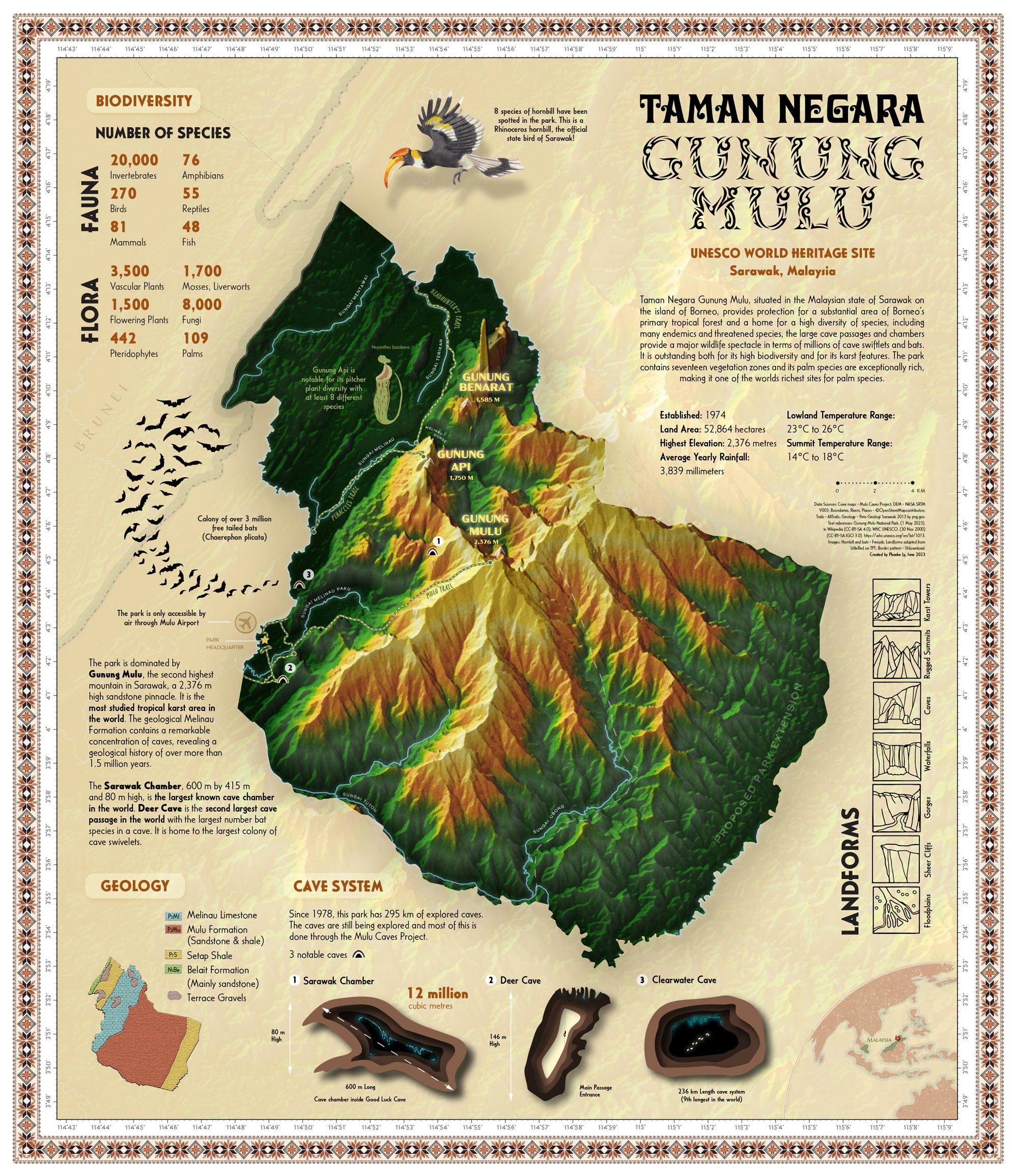
Taman Negara Gunung Mulu (Mount Mulu National Park), is a UNESCO World Heritage Site in Sarawak, Malaysia. My home country. Despite its unique and enormous cave system, there are not many maps or infographics for Taman Negara Gunung Mulu. The purpose of this map is to educate the public about Taman Negara Gunung Mulu’s rich biodiversity and spectacular cave system in a well-designed and easily comprehendible poster. The map design was crafted to match a theme in harmony with the tropical forest and indigenous tribal designs of Sarawak.
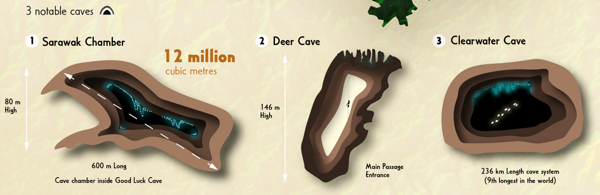
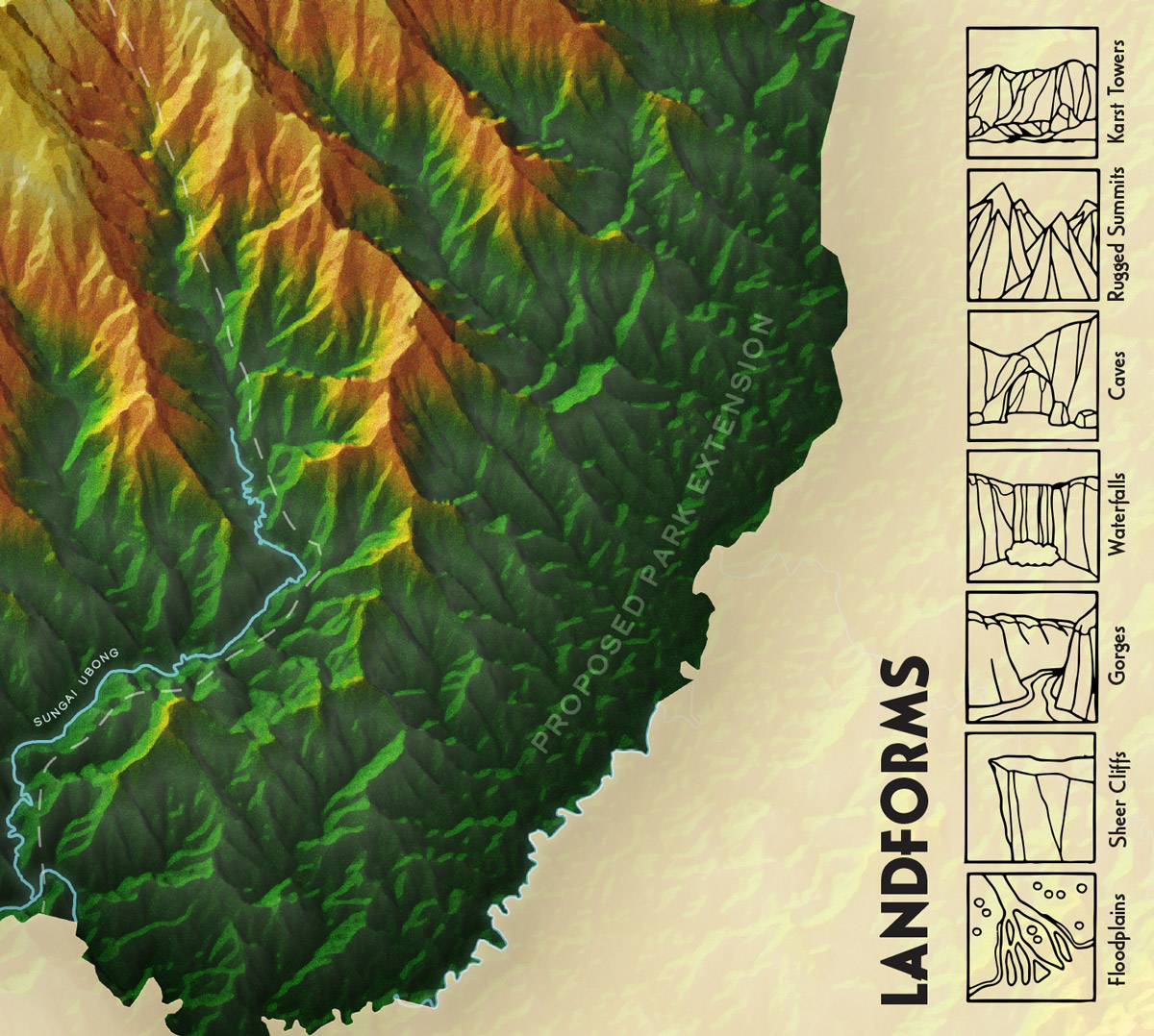
The map is centered on the national park from a plane oblique view that highlights the mountainous and rugged terrain. It is so remote that the only access to the park is by flying into Mulu airport. The main airport, rivers, trails, mountain peaks, and notable cave locations are shown. I wanted to highlight the three most notable caves within the Mulu cave system, Sarawak Chamber (inside Good Luck Cave), Deer Cave, and Clearwater Cave. I also included a small generalized geology map for reference. For the information on biodiversity and landforms, my aim was to make it easily readable yet engaging by playing with typography and illustrations.
The base map was created using three-arc-seconds DEM, which was processed using plane oblique and hill shade tools in ArcGIS Pro. Cave locations were georeferenced from images by Mulu Caves Project. The layout, labels, and map design were all completed in Adobe Illustrator, including original cave illustrations.
Have a look at all the interesting details in the original pdf (18mb).
The map was created as part of the course Project Map Creation at TU Wien in summer semester 2023.
Student: Phoebe Ly