DormEase: Munich Dormitory Explorer
"Transforming Munich's housing hunt with precision and ease - your personalized map to dormitory bliss."
What it is about
Inspired by the challenges faced by students and newcomers in Munich, we embarked on a mission to create an intuitive and comprehensive Interactive Web Application Map that caters to the diverse needs of individuals searching for dormitories in Munich. Our map serves as a one-stop platform for users to access detailed information about the surrounding neighborhood, including the proximity to educational institutions, recreational facilities, public transportation, and other essential amenities. It's not just about finding a dorm; it's about making informed decisions that match a unique lifestyle. Our application prioritizes an intuitive user experience, ensuring that even individuals with limited technical expertise can easily navigate and utilize the platform.
How we built it
To gather data, we directly extracted POIs from Google Maps and OpenStreetMap. Additionally, we sourced dormitory descriptions from various relevant websites, extracting suitable details about each accommodation option. We utilized QGIS and ArcGIS Pro to improve and process the spatial data. For geospatial analysis and data manipulation, ArcGIS Pro provided a powerful environment, while QGIS, being an open-source alternative, complemented our toolkit for specific data cleaning tasks. To translate our processed data into an interactive format, we turned to ArcGIS Experience Builder. This platform allowed us to create a dynamic web map that integrates seamlessly with our processed spatial data.
Challenges we ran into
Our primary challenges revolved around data extraction and visualization. Extracting information from dormitory websites proved challenging due to the majority of content being in German, posing difficulties for us as beginners in the language. Additionally, some websites did not provide the required data, such as pricing, resulting in partial data gaps. Moreover, the limited interactive tools offered by ArcGIS Online necessitated careful consideration and exploration of alternative methods for presenting information.
What we're proud of
Despite facing challenges along the way, we successfully achieved our project goals as outlined in our initial plans. While some data didn't display as expected due to software limitations, we actively sought alternative methods and effectively presented relevant dormitory information with interactive features.
What we learned
The project brought together skills from diverse disciplines, including geography, web development, and user experience design. We learned to effectively collaborate across these domains to create a comprehensive solution. Through this journey, we gained proficiency in data processing using ArcGIS Pro and QGIS, along with creating interactive web applications on ArcGIS Online, expanding our skill set in geospatial technologies.
What's next
In the future, we suggest regularly updating dormitory information to reflect changes such as price adjustments, the establishment of new dorms, and closures for renovations. Additionally, there is a potential to enhance the user experience by incorporating transportation details, including modes and durations from dormitories to universities, providing a more comprehensive view of relevant information.
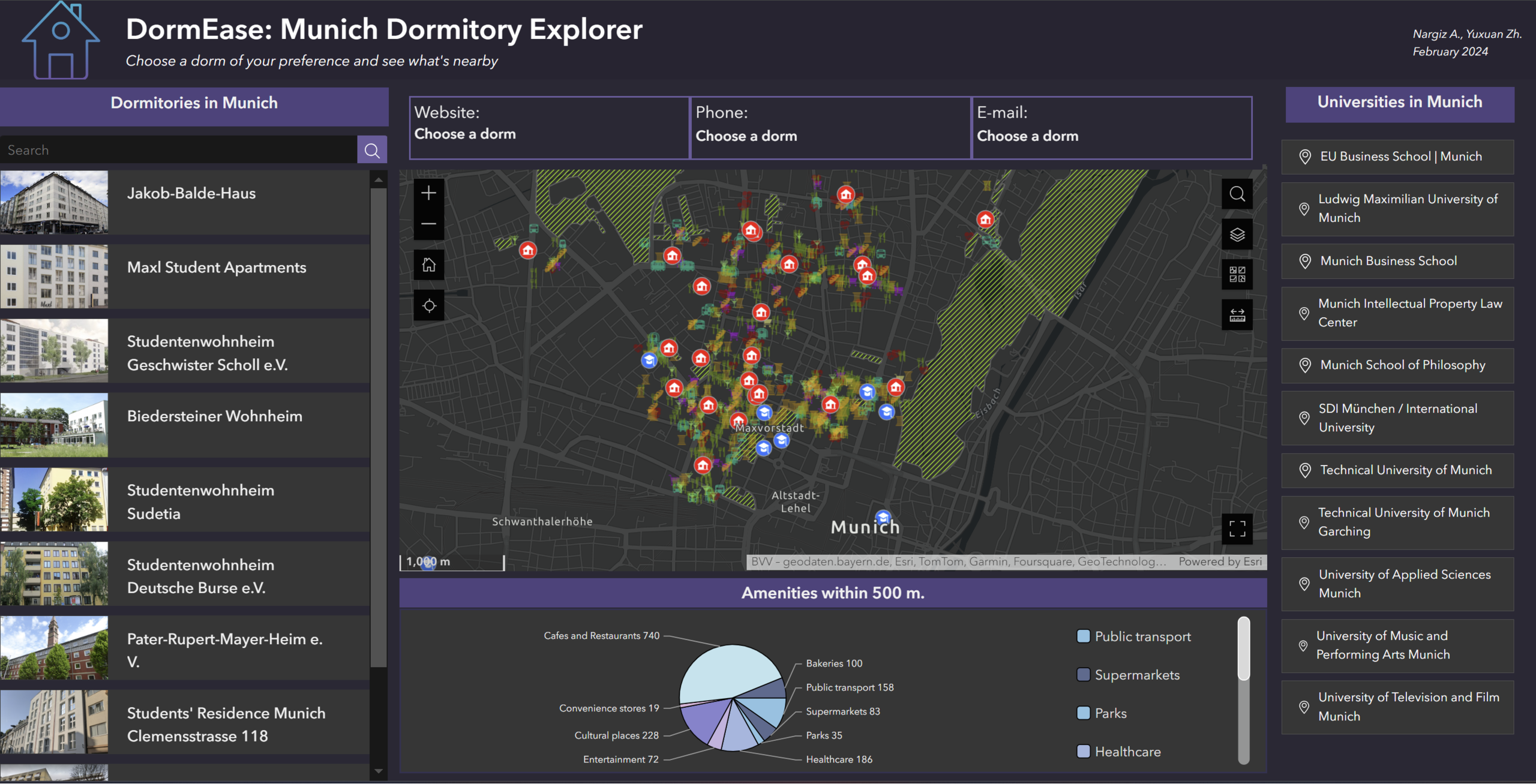
Overview of our web application.
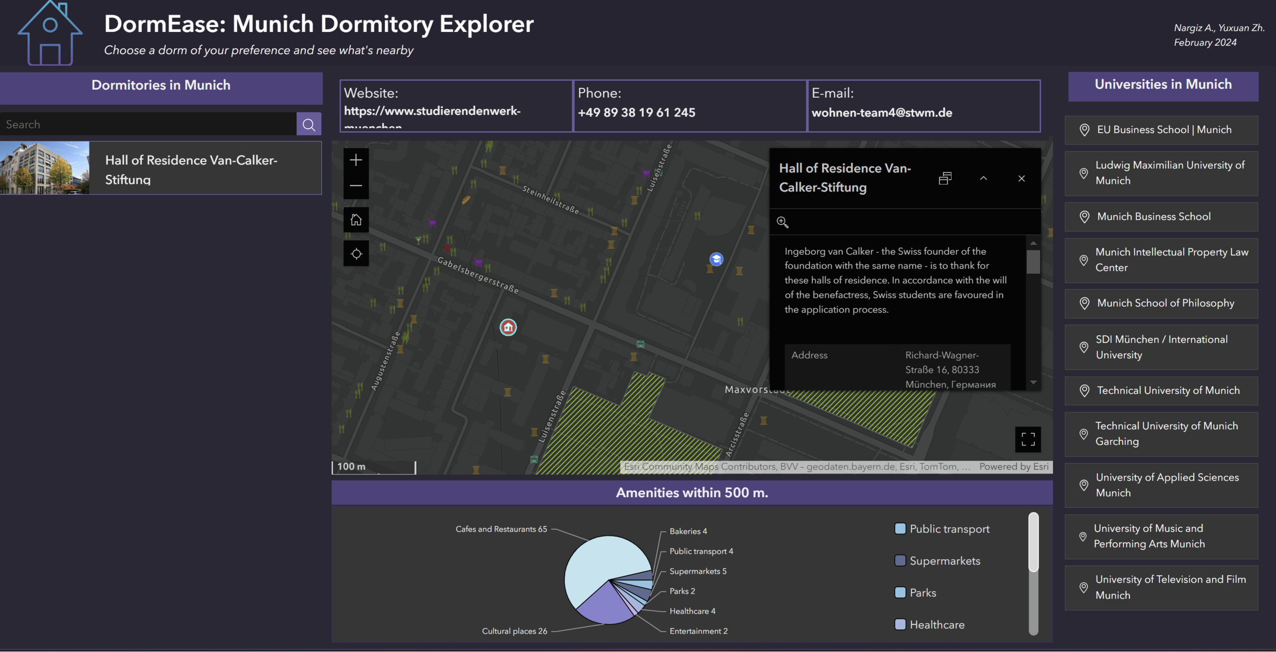
Dormitory selection process.
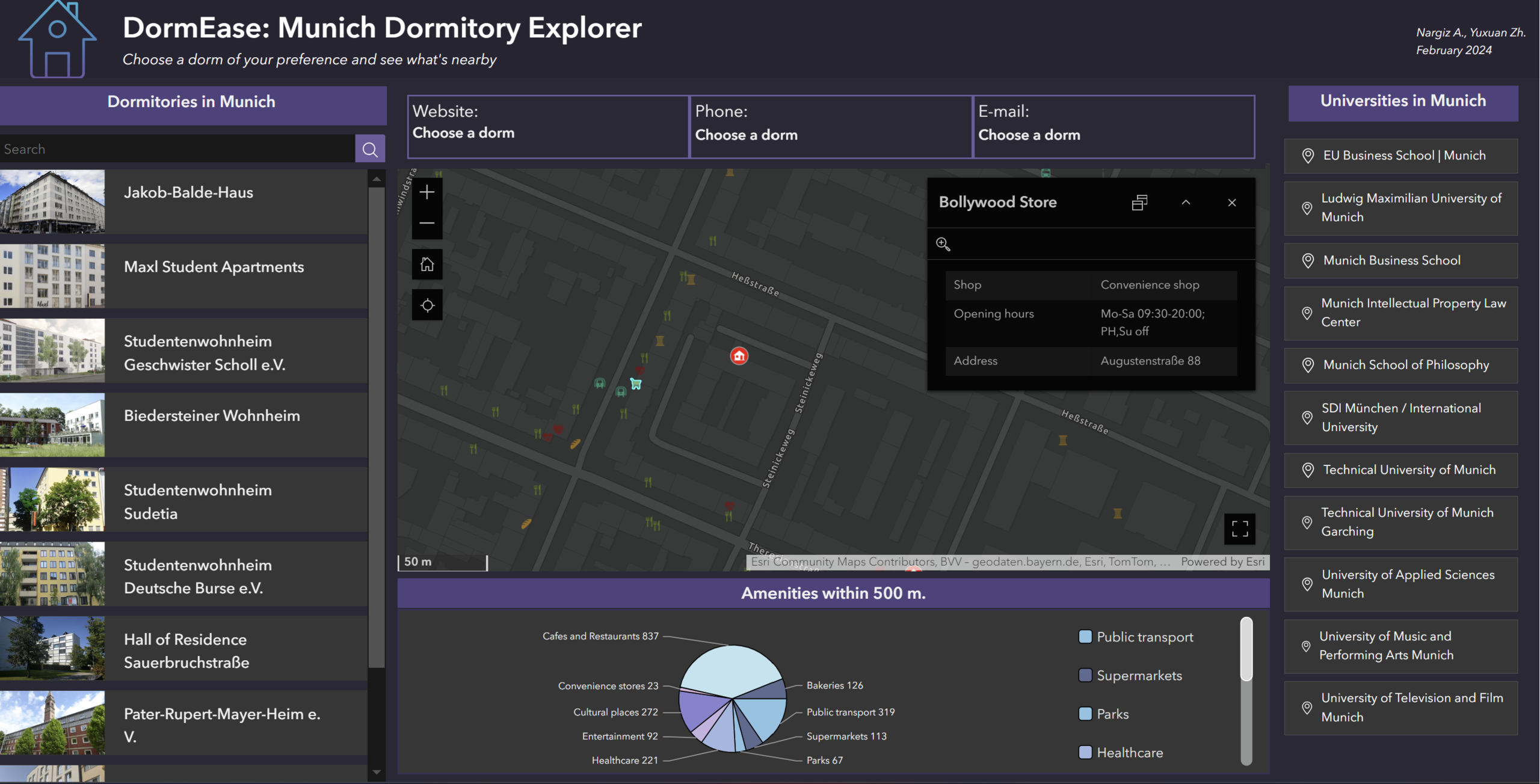
Amenity selection process.
Students
Nargiz Amralina
Yuxuan Zhang
Yuxuan Zhang
13th intake
Supervisor
Juliane Cron, M.Sc.
Keywords
Dormitory, Munich, Personalization, Interface
Try it