A carto-cast about Willem Barentsz – a navigator, cartographer and Arctic explorer: https://storymaps.arcgis.com
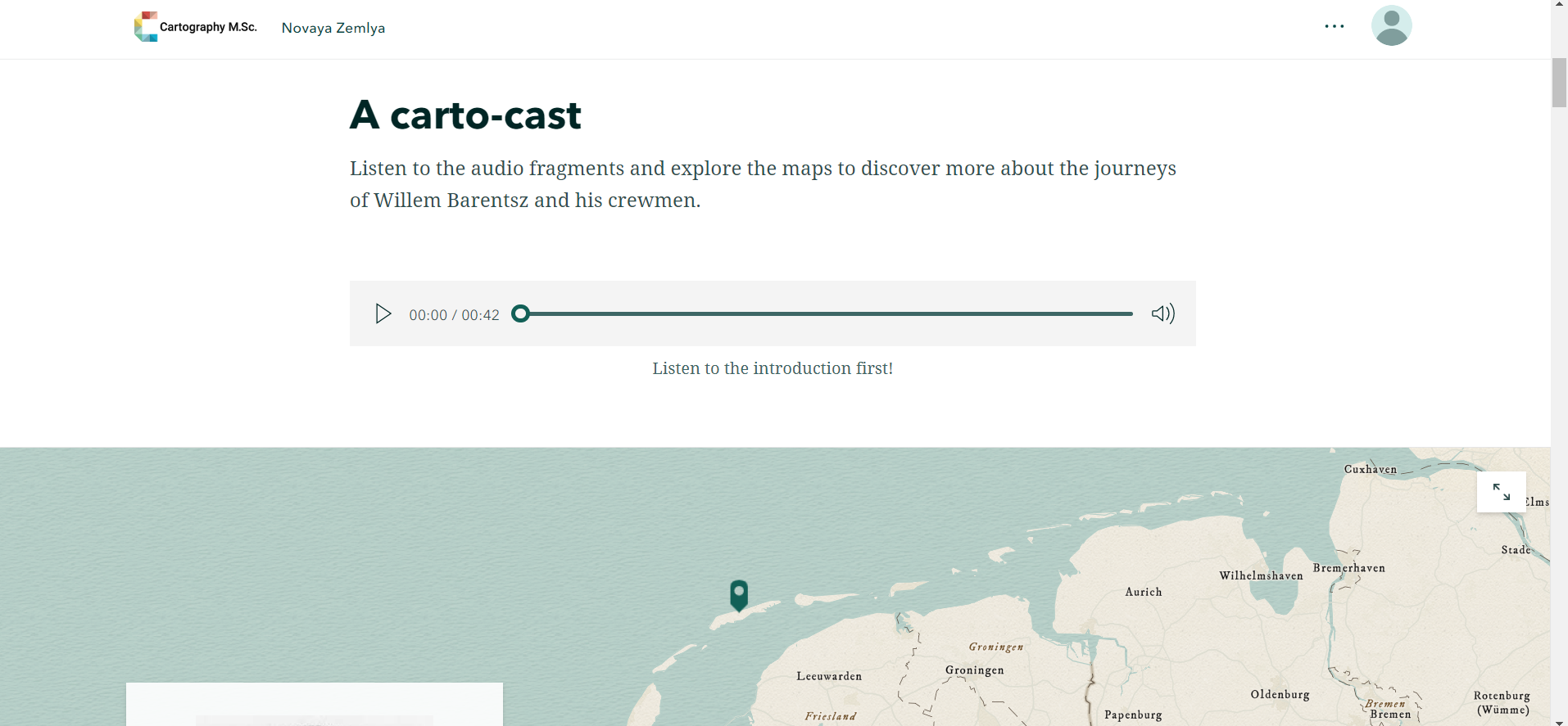
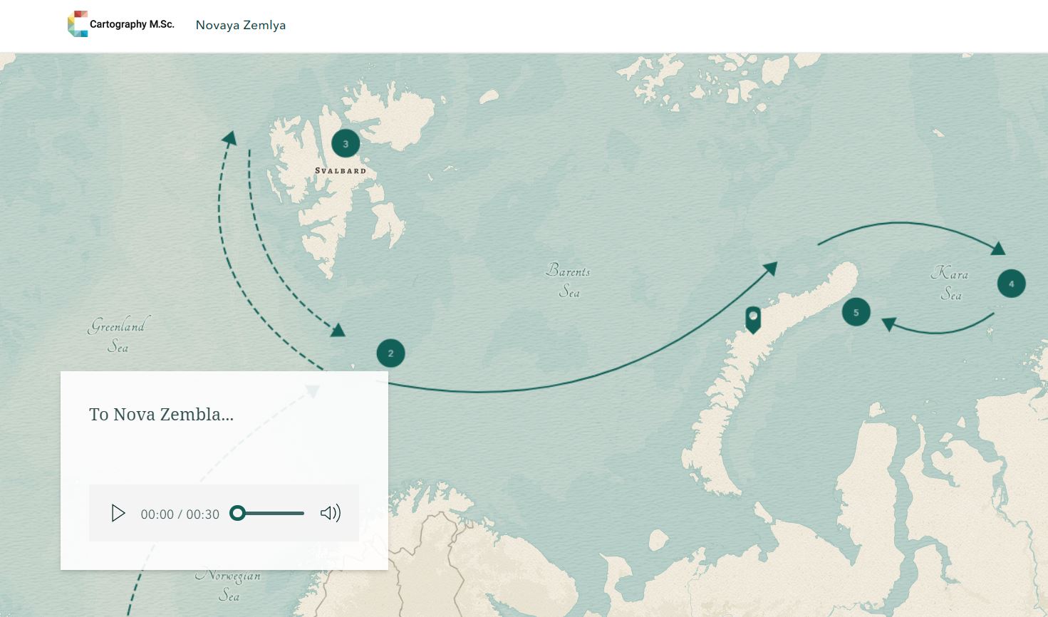
Cartography once started with the mapping of unknown regions, quite different from what we are used to nowadays, when we already know what the world looks like. One of the people that contributed to this mapping of unknown regions was the Dutch cartographer and navigator Willem Barentsz. His story and how the life of a cartographer used to be in the 16th century is told in our carto-cast.
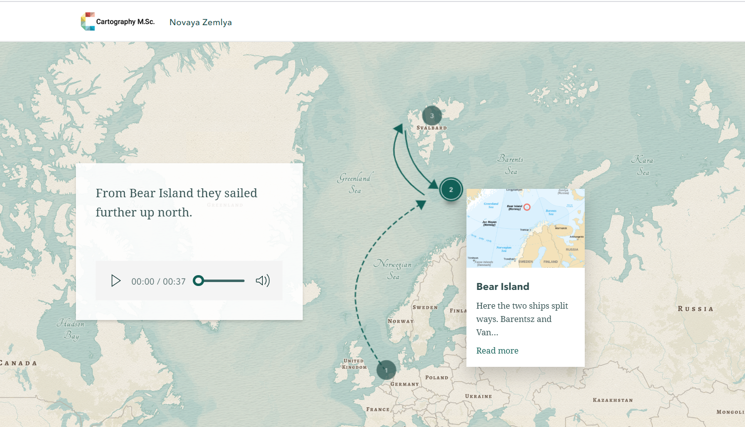
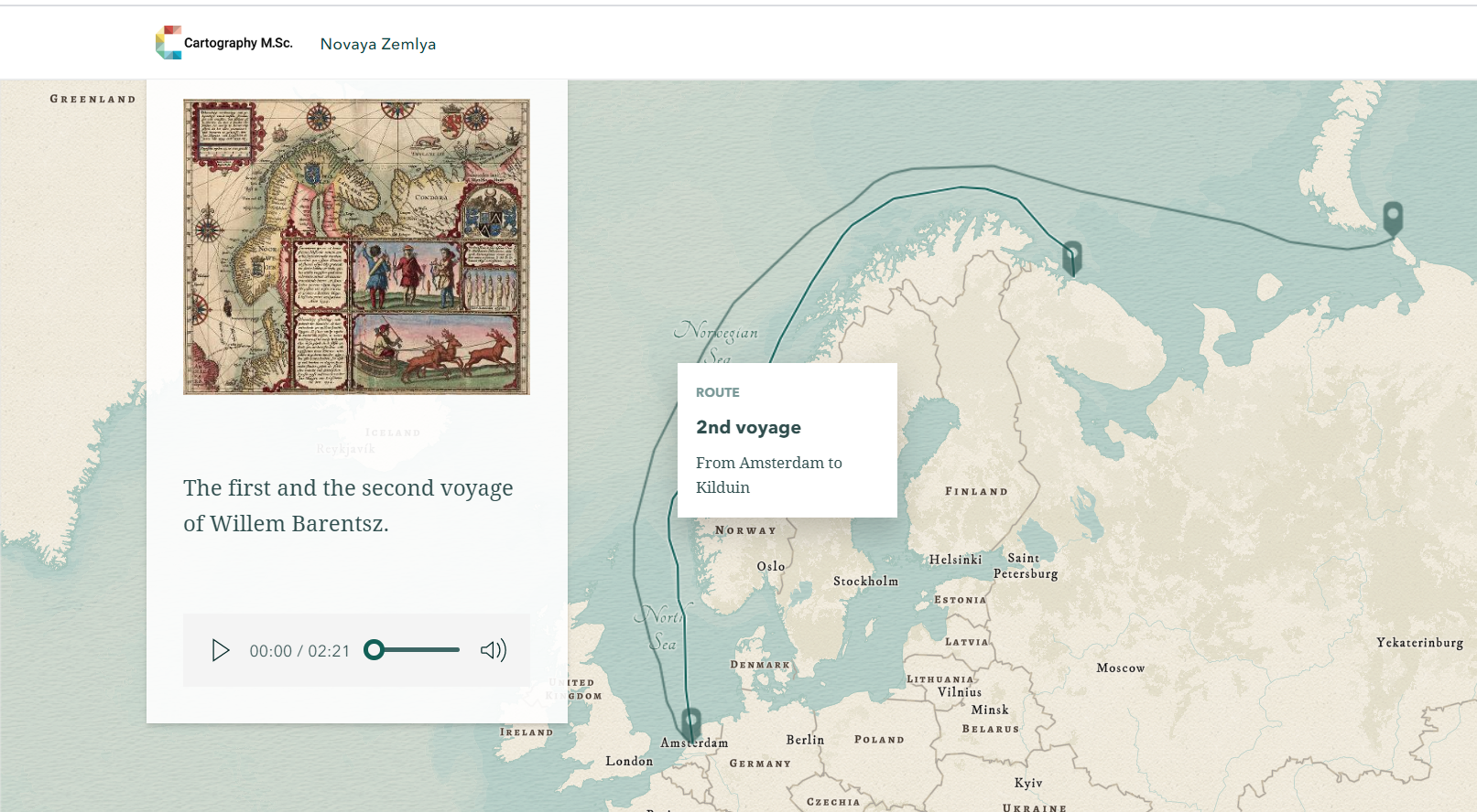
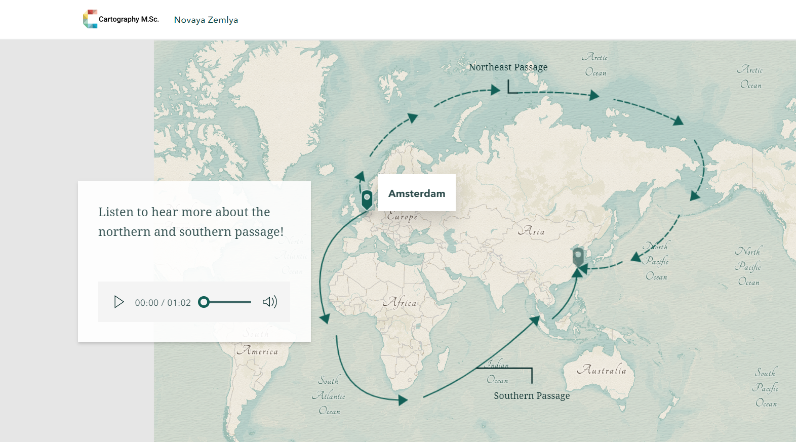
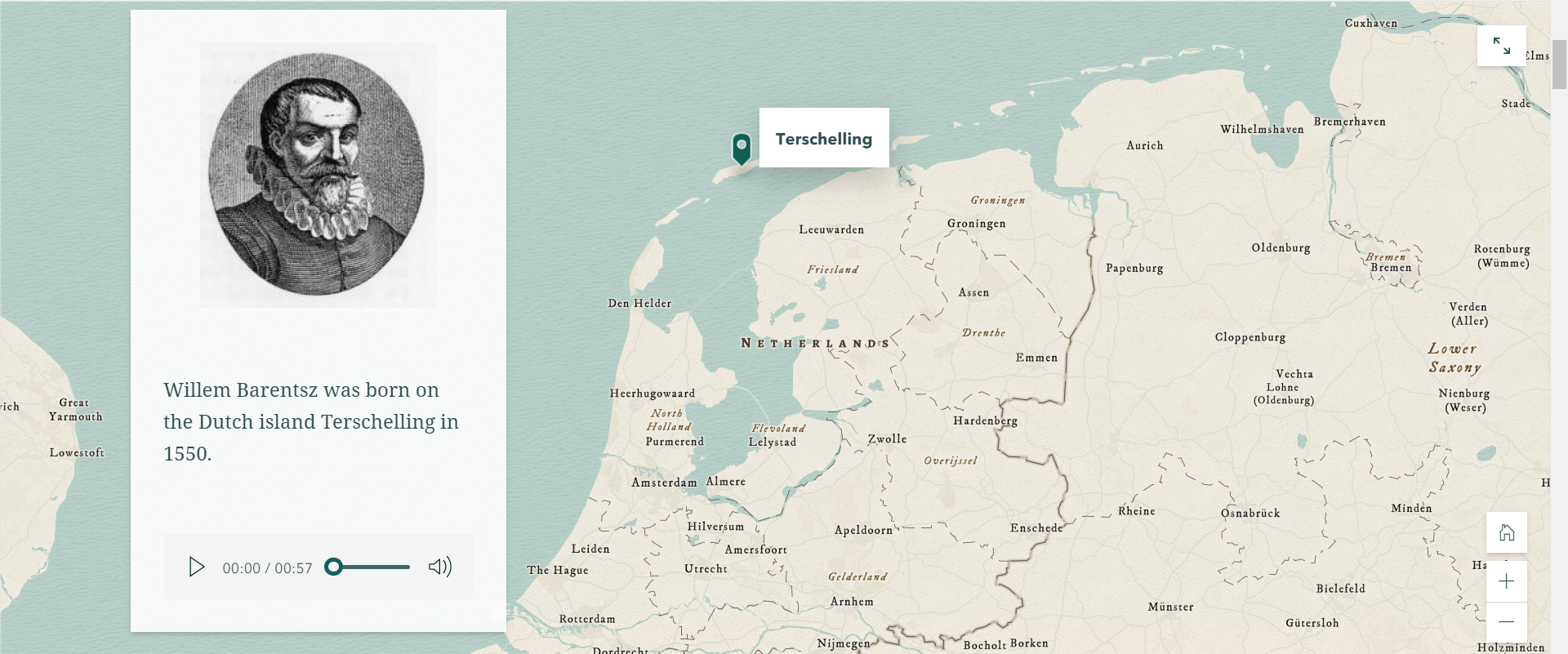
For the course Multimedia-Cartography and Geocommunication we created this carto-cast. The carto-cast is a multimedia podcast. All the research on Willem Barentsz and the recordings we made were put together in an ArcGIS story map. Every slide contains a map that displays the information discussed in the audio fragment. These maps are also interactive. You can zoom and click on the points of interest and on the routes. You can also read more additional information on these locations there. Once you listened to the audio fragment and explored all the information from this segment, you can go to the next slide and listen to the next part of the story. Together all the audio fragments, maps and illustrations tell the story of the three voyages of Willem Barentsz while trying to discover a Northeast Passage to China. The carto-cast can be found online.
Students: Anouska Jaspersen, Nargiz Kurumbayeva, Shlesha Acharya, and Stephanie Fovenyessy
The map was created within the class Multimedia-Cartography and Geocommunication at TU Wien in summer semester 2020.