This region is an iconic landscape that envelops Mexican nature and culture. However, few
hiking maps have been made to satisfy the increasing demand of nature explorers to the
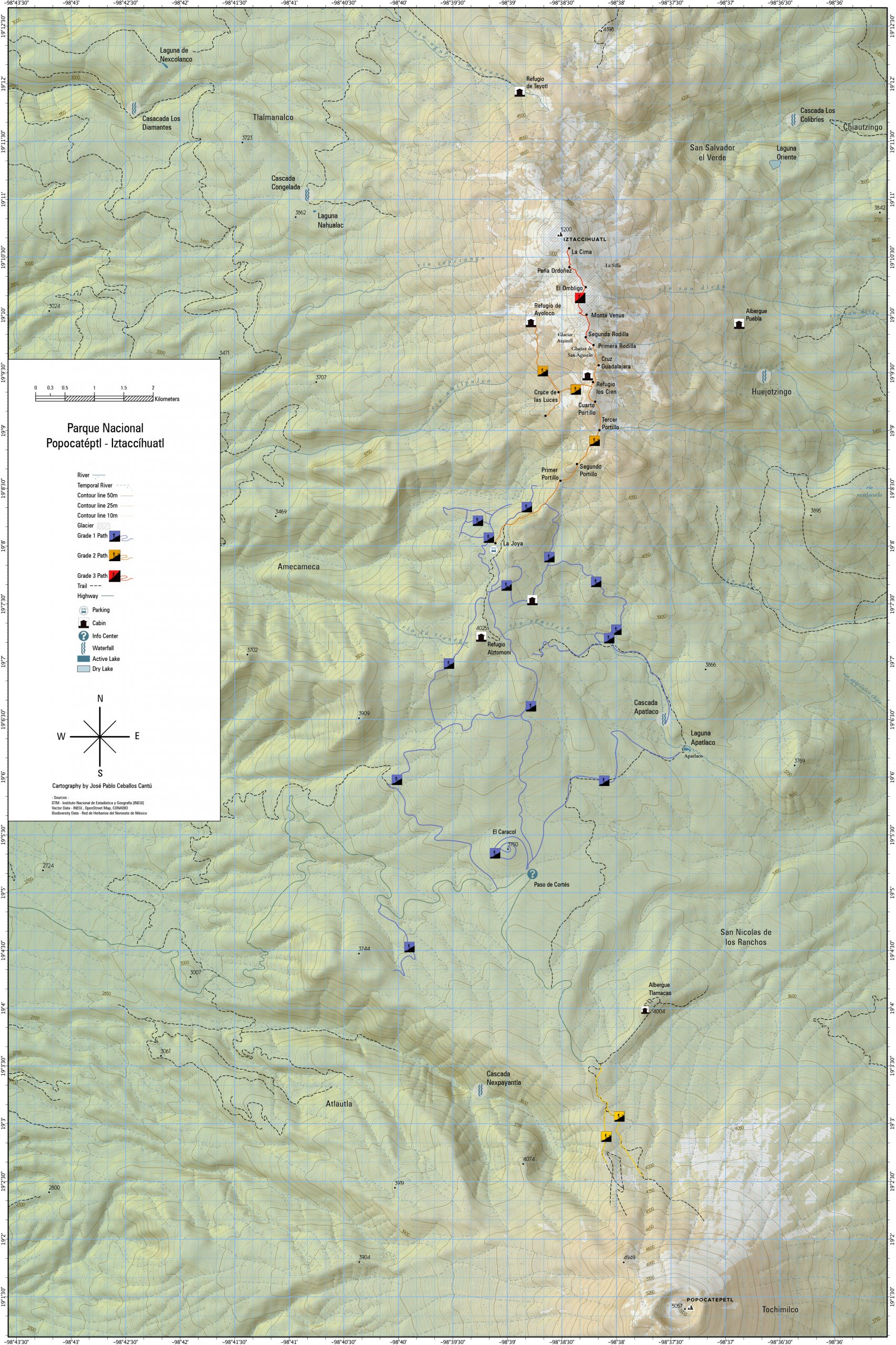
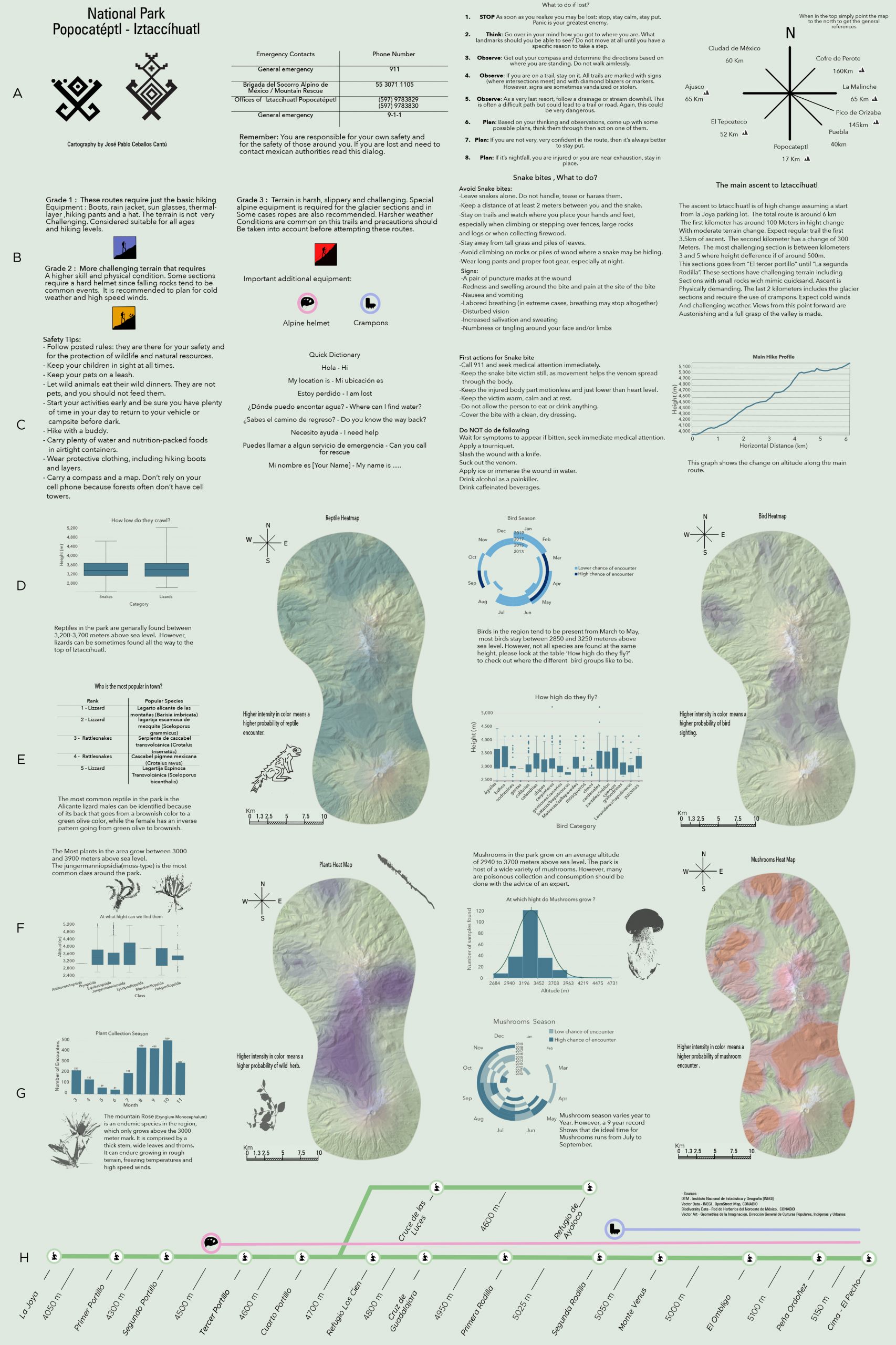
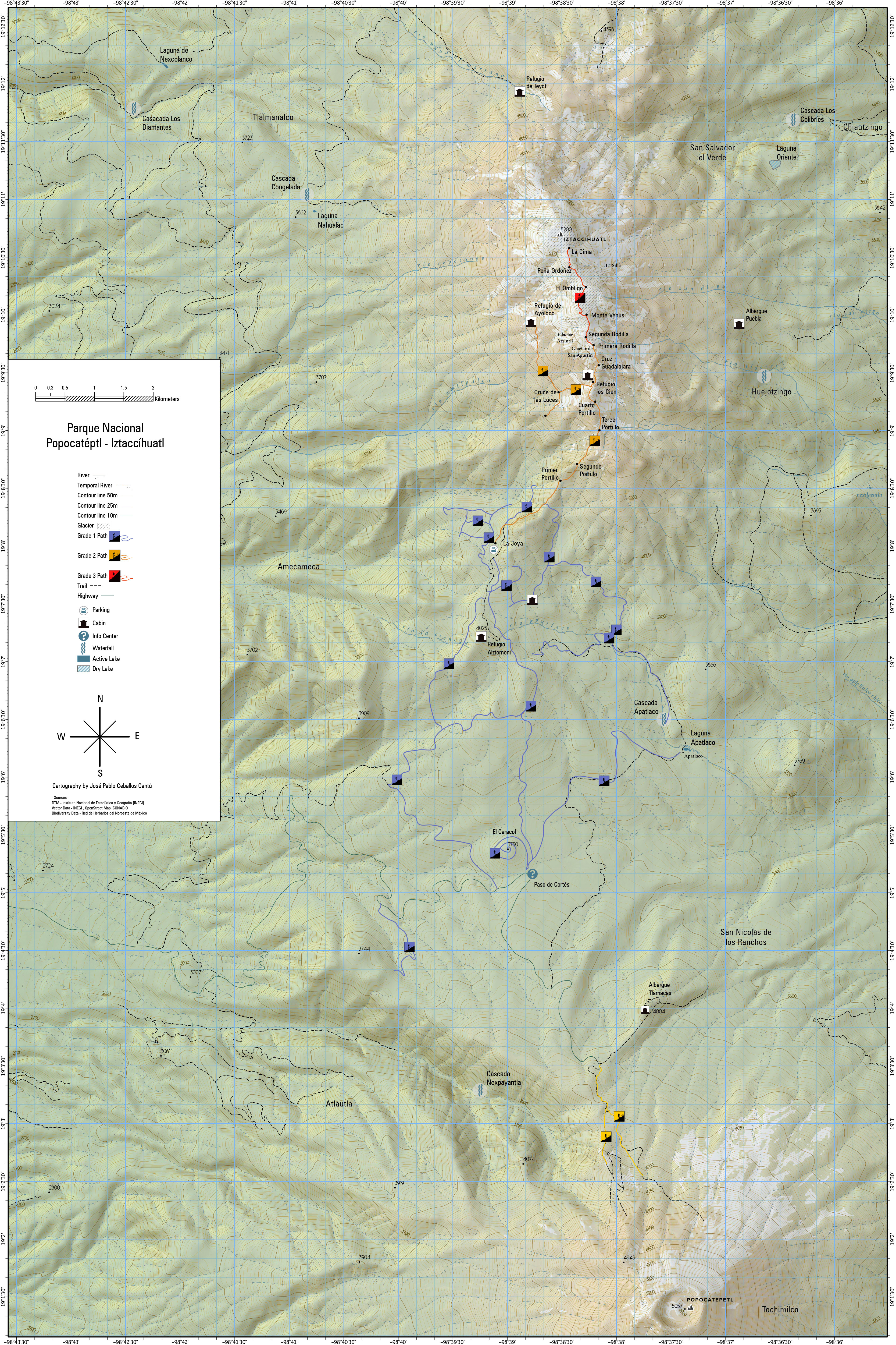
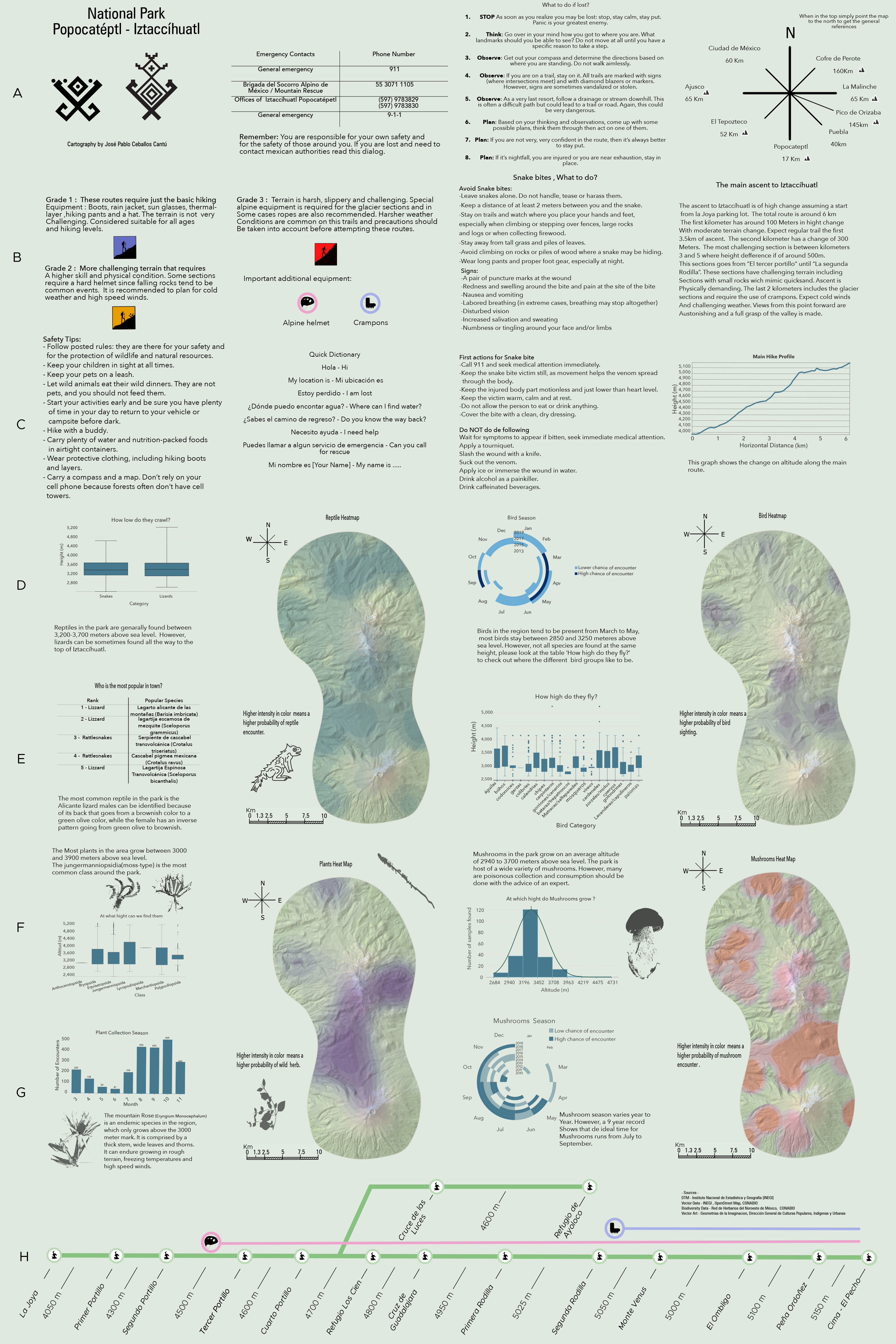
region. The map’s main objective is to showcase the main routes in the region while also
providing relevant biodiversity information. A foldable map intended to educate, explore and
connect in a safe manner with this precious region.
The base map was created using INEGI’s DEM in combination with ArcGIS and satellite images
from the region. Information in regards to the routes was retrieved from different hiking and
OSM data repositories. The design of the map and its back part was done in Affinity Designer.
The map is intended to be printed on an architectural format 600mm×900mm, with a back
print.
The map was created within the class Project Map Creation at TU Wien in summer semester 2021.
Have a look at all the interesting details in the larger version in jpg format: front (2,7mb), back (7,1mb).
Student: Jose Pablo Ceballos Cantu