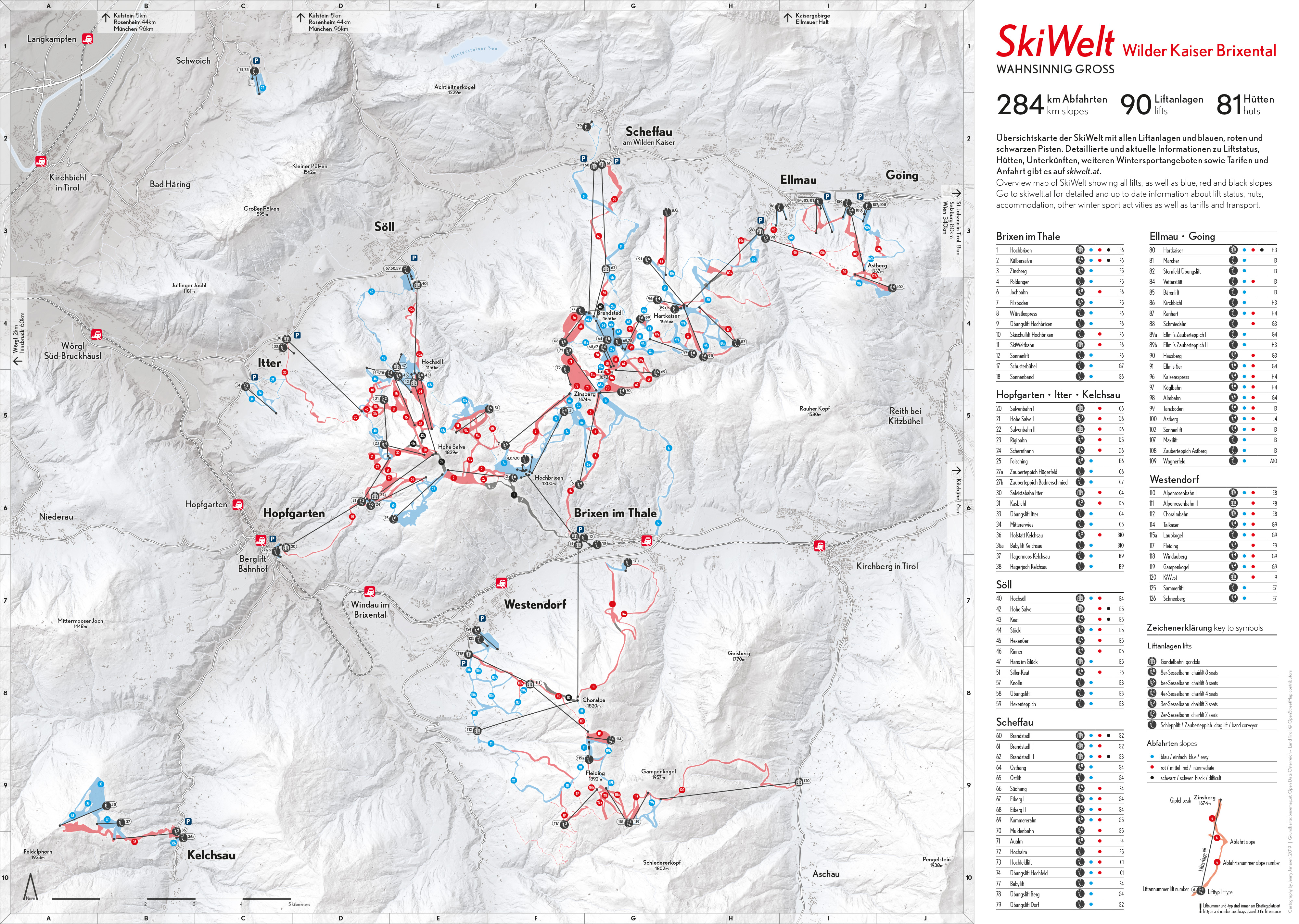
The idea was to create a print map which could provide an alternative to the traditional panorama map, where heavy geographical distortion is required in order to show the extent of the ski resort, its lifts and slopes. The intention was not to entirely replace the traditional panorama map, but rather to provide an additional, more geographically accurate wayfinding tool to enable users to navigate large ski resorts. Easily understandable, larger-scale navigation tools are especially important to users who are new to the resort and for identifying the best route via which to descend at the end of the day.
The map was created using primarily Adobe Illustrator CC with Avenza’s MAPublisher GIS plugin as well as Adobe InDesign CC. The terrain model was retrieved from basemap.at using QGis and later overlaid with a gradient map using Adobe Photoshop CC. The data used and displayed on the map was retrieved from OpenStreetMap and Open Data Österreich. The print format is A2.
The map was created within the class Project Map Creation at TU Wien in summer semester 2019.

Have a look at all the interesting details in the larger version in jpg format (3.4mb).
Student: Jenny Janssen