Cumbre Vieja volcanic eruption: Cartographic animation on a 3D print
"Another dimension of storytelling and education thanks to physical maps with a digital twist."
What it is about
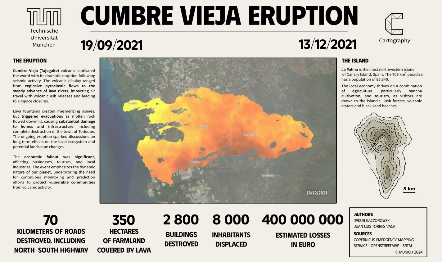
The main goal of this project was to develop a physical visualization of the 2021 Cumbre Vieja volcano eruption that could serve as a tool to help individuals understand the sequence of events and the impact of natural disasters such as volcanic eruptions. The key aims of this project are:
· Create a detailed physical 3D model that represents the eruption of Cumbre Vieja volcano and its surrounding area, including infrastructure destroyed.
· With the overlay animation including a voiceover, provide a resource that can raise awareness and enhance understanding regarding volcanic eruptions and their possible impacts.
How we built it
We started our project by collecting data from Copernicus Emergency Management Service and OpenStreetMap. To generate the 3D model we used QGIS and UltiMaker Cura, while the base was designed in Inkscape. Both the 3D printing of the model and the laser engraving and cutting of the base were made using equipment of Munich’s MakerSpace. It’s worth mentioning that we took two additional courses to learn how to use the machines. The spatial analysis to obtain the number of buildings destroyed each day and the map animation were done in ArcGIS Pro. Finally, Sony Vegas was the software used to create the final video with audio created using AI tools.
Challenges we ran into
We encountered technical problems during the printing process and thanks to the assistance of the MakerSpace staff we successfully addressed these issues. Additionally, during the creation of the final video and testing it on the 3D model we found out how difficult it is to properly fit the animation considering the natural inclination of the model and the distance and angle of the light source.
What we're proud of
We created a useful map-based tool which can be used for diverse purposes. At the same time, we learned how to deal with new technologies and tackle the challenges of creating complex projects like this.
What we learned
During different stages of this project, we learned:
- Creation of 3D models from Digital Elevation Models and 3D printing.
- Design for laser engraving and cutting and use of equipment for that cause.
- Creation of animations in ArcGIS Pro. - Audio production with AI-based tools.
- Video production in Sony Vegas.
- Beaming animation on an uneven surface.
What's next
We would like to improve the precision of the map visualization on the 3D model by adjusting and testing different angles and distances of the beamer, while adding more cartographic elements such as scale bar, more symbols or some graphs. Also, now that we know the principles of 3D printing and laser engraving, we would love to experiment with more designs and areas of the world.
Mockup of the final product with projected animation and laser-cut contour map.
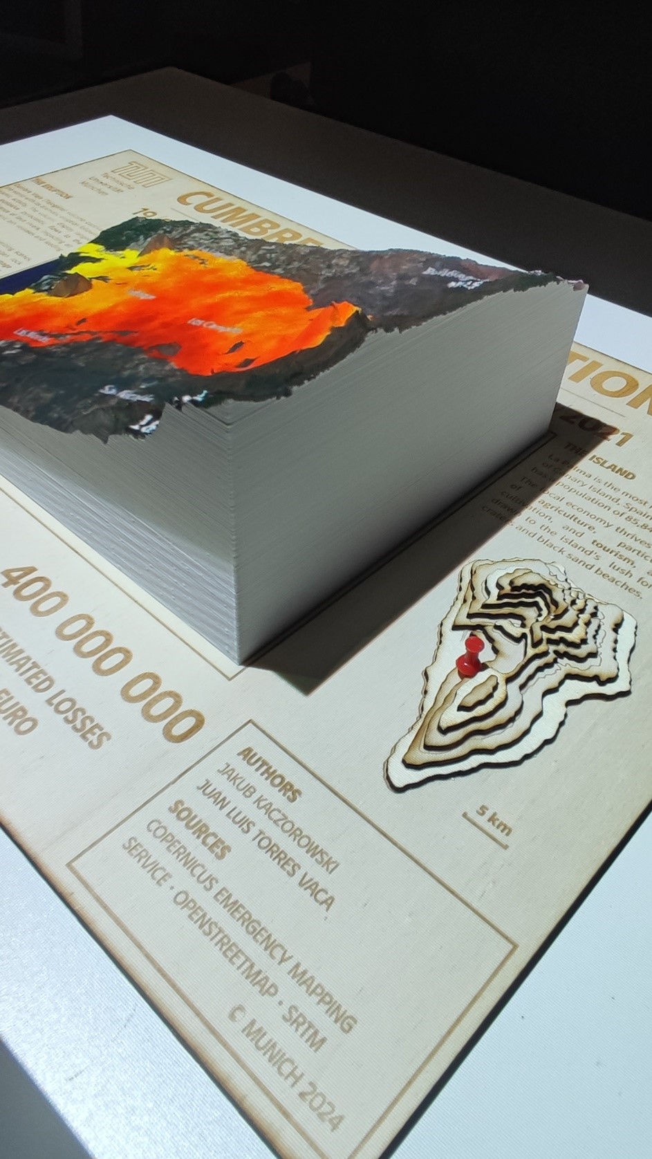
Photo of the final product: laser-engraved base, 3D print with projection and laser-cut contour map.
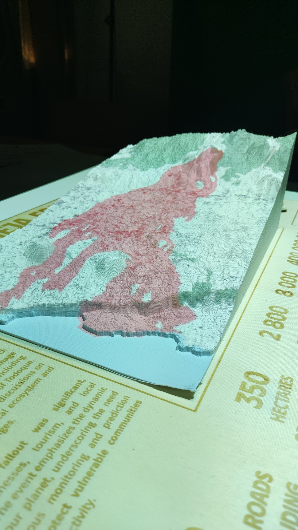
Photo of the final product: projection of final lava cover and location of destroyed buildings and roads.
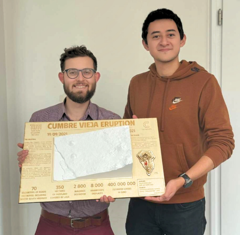
Students
Jakub Krzysztof Kaczorowski
Juan Luis Torres Vaca
Juan Luis Torres Vaca
13th intake
Supervisor
Juliane Cron, M.Sc.
Keywords
Volcanic eruption, disaster management, storytelling, spatio-temporal analysis, 3D printing