The Living Past of Munich: City as a Palimpsest
"Munich is a city full of tangible memories"
What it is about
Our project aims to illustrate the concept of a city as a palimpsest through the web map. This theory draws an analogy between the city’s historical layers and the textual layers of a palimpsest (a layered manuscript that retains traces of its earlier content beneath the surface). In this metaphorical sense, the city is viewed as a complex composite, consisting of multiple layers of history, culture, and architecture, where the past and present live together, overlap, and intertwine. Our interactive map displays the patchwork of urban elements from different historical periods coexisting in Munich, unraveling the city's living past.
How we built it
Data Collection
The data about various elements of the city (buildings, open spaces, and spots) was manually gathered for over 250 sites in Munich. To achieve this, we reviewed numerous resources: books, articles, maps. Also, we visited the collections of the Munich City Museum, from where we collected more relevant data. The resulting dataset encompasses over 10 attributes for each location, including details such as name, year built, type, function, architect/creator, address, and links to additional resources.
The data about various elements of the city (buildings, open spaces, and spots) was manually gathered for over 250 sites in Munich. To achieve this, we reviewed numerous resources: books, articles, maps. Also, we visited the collections of the Munich City Museum, from where we collected more relevant data. The resulting dataset encompasses over 10 attributes for each location, including details such as name, year built, type, function, architect/creator, address, and links to additional resources.
Data Processing
To create spatial data from the data table, we geocoded addresses using the "Geocode by Awesome Table" extension in Google Sheets. Further steps were taken in QGIS: checking the results of geocoding and assigning building/site characteristics to polygons from OSM. The polygons corresponding to the parks, cemeteries, and squares were manually added in QGIS, based on reliable sources.
Data Visualization
Beyond the interactive map visualization (front-end part) lie thousands of lines of JavaScript code utilizing React.js. The specific web-GIS libraries used are MapLibre and React Map GL. Additionally, we have integrated a back-end component using Node.js and Express, which enables users to add their own data to our database.
Challenges we ran into
Since most of our data was being collected manually, we knew from an early stage that it would be humanly impossible to gather information about every building in Munich within the time we were given to develop this project. We aimed to include as many iconic and historical buildings and spots, popular parks and open spaces, and memorials as we possibly could.
What we're proud of
We faced challenges and some of them turned into strengths. Besides the time constraints for data collection, we are very proud of the data table we managed to create. As we previously mentioned, it includes information about more than 250 sites and encompasses more than ten attribute fields for each one of them. We turned this constraint into an opportunity by creating the “Make Map Live <3” feature, which invites users to contribute with data and site suggestions. For this purpose, we integrated a form on our platform that receives this information and after moderation, will be added to our dataset. Moreover, this makes our map dynamic and offers a view of the city from the perspective of its residents, visitors, and experts.
What we learned
Project management, time management, and data management are essential skills for groups involved in mapping projects since they are key to achieving successful results. We have undoubtedly made improvements in these areas while creating our map. Still, we aim to collect more expertise on these areas to be able to, for example, be able to collect bigger amounts of data within a shorter time. This would give us a higher reach on future projects or in expanding this one too.
What's next
Our map is dynamic, therefore, it can be easily enriched with additional information about various urban sites, both by us and by users. This enhances its value as a resource tool for urban planners and anyone interested in Munich's history and urban landscape.
Implementing an adaptive design for the mobile version could further enhance user-friendliness, allowing people to discover Munich "on the go," with no need to explore all the data on a laptop screen or other monitors.
Our project can be extended to showcase the palimpsest of any city in the world if there are volunteers interested in collecting and adding the data for it.
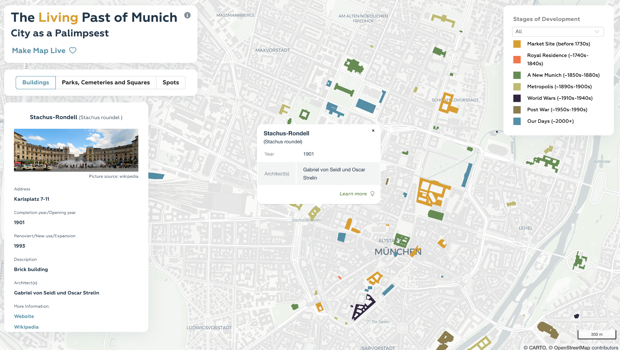
Buildings in Munich city center. The Pop-up window and information panel with additional information will appear on the map after clicking on the polygon and button “Learn more”, respectively.
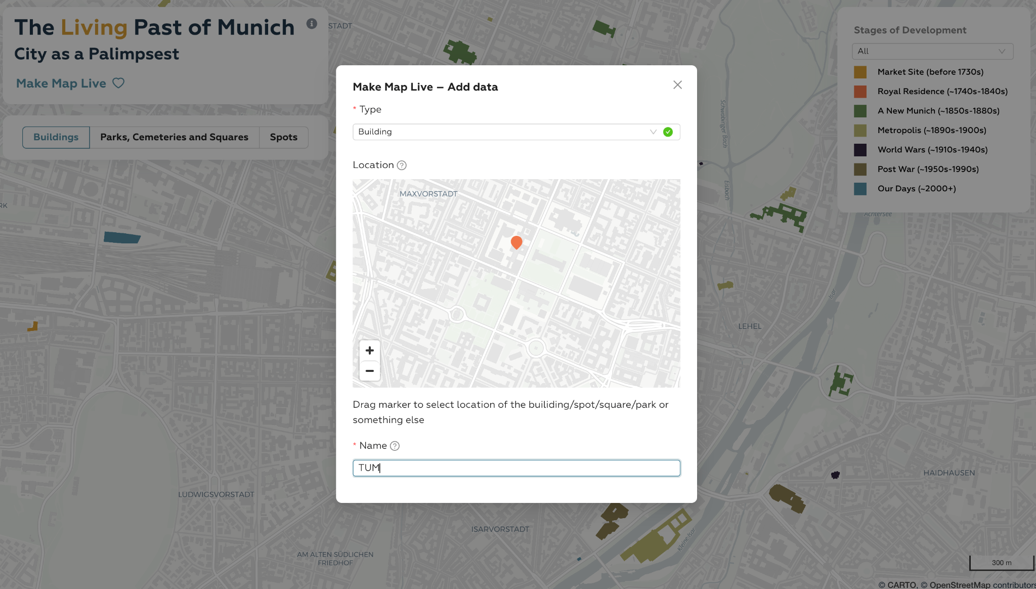
Form for users to contribute to our project and add data. The red pin is drag able and is used for selecting locations.
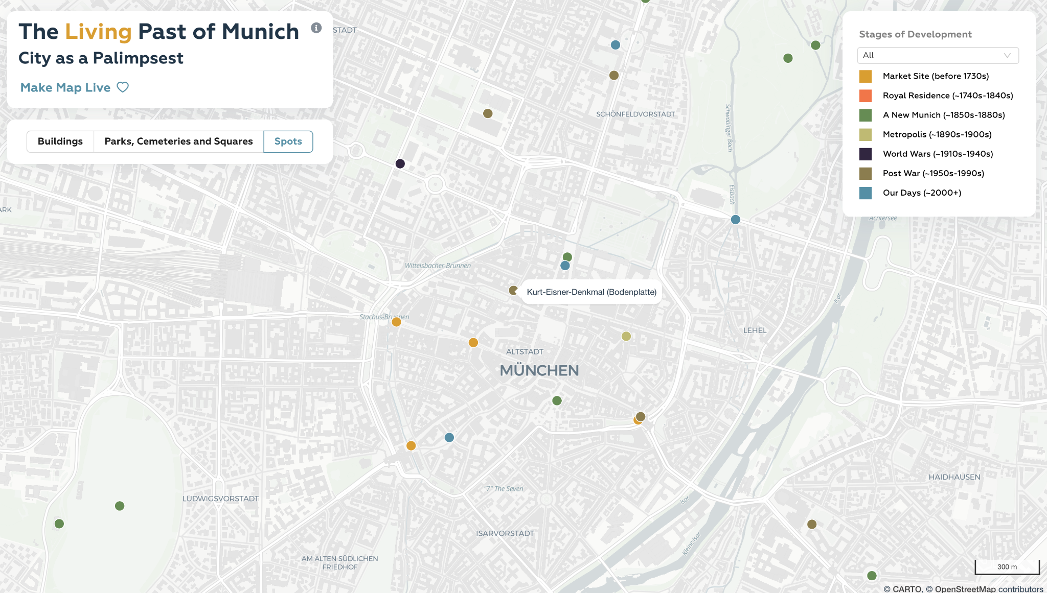
Spots in Munich City center. The name for each location appears on the map after you hover over the point.
Students
Bella Mironova
Joselyn Salinas
Joselyn Salinas
13th intake
Supervisor
Juliane Cron, M.Sc.
Keywords
Palimpsest, Munich, urban history, architecture, heritage, web-map
Try it