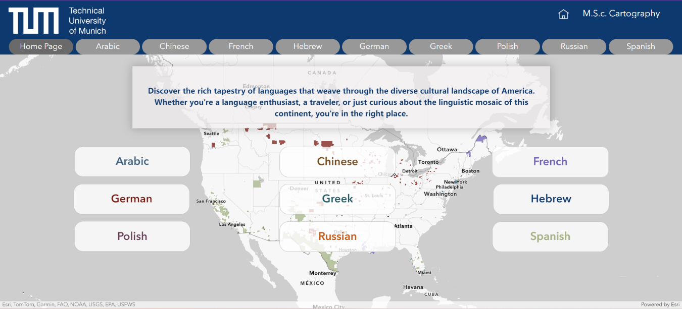
The United States is one of the most racially and ethnically diverse nations globally. In 2016, the United States Census Bureau made a significant update to their language dataset, which includes 42 language categories, including languages from Africa and Asia [1]. The creation of this application serves as a valuable tool for users to explore and comprehend the extensive spectrum of languages spoken across the United States. Utilizing an interactive format, we allow users to zoom in to specific regions or zoom out to have a broader overview of the country.
U.S. Language Map
"The rich tapestry of languages that weave through the United States."
Integration of Dashboards within ArcGIS Web Experience.
What it is about
How we built it
This application was developed using ArcGIS Online, integrating various dashboards and web maps to create the final Web Experience. Our initial steps involved selecting, cleaning, and preparing the data. Once the final dataset was established, we conducted analyses to determine the most suitable method for classifying the data to be displayed on the web maps. We then assigned predefined color ramps to the data and created dashboards to enhance the clarity of the presented information. Finally, we replicated this process for each language supported.
Challenges we ran into
Developing an application within the Web Experience of ArcGIS Online presents its own set of challenges, notably concerning the management of roles and privileges within our account, the design limitations principally in the screen size, and the restriction to add images into the lists in the dashboards. Additionally, we faced challenges related to the classification, where in many cases, the data was skewed towards one side. We also faced challenges associated with map projection due to ArcGIS Online's default use of web Mercator. While there are methods to alter the projection, none proved optimal for our specific project.
What we're proud of
We are proud of the overall utility and usability of our web application. Our application efficiently displays the regions with higher percentage of a spoken language throughout the United States, exhibiting a low error rate and being both easy to learn and remember.
What we learned
During this project we gained practical experience in the cartographic process. Additionally, our learning extended beyond the languages spoken in the United States; we also gained insights into ArcGIS Online and the integration of its products.
What's next
Incorporating multilingual translation capabilities into our application has the potential to significantly improve accessibility and inclusivity for all users, especially those who may not be proficient in English. Furthermore, this feature can assist users in seeking a suitable neighborhood when moving abroad or in fostering the development of stronger communities. Unfortunately, we faced difficulties in finding an accessible solution for its implementation.
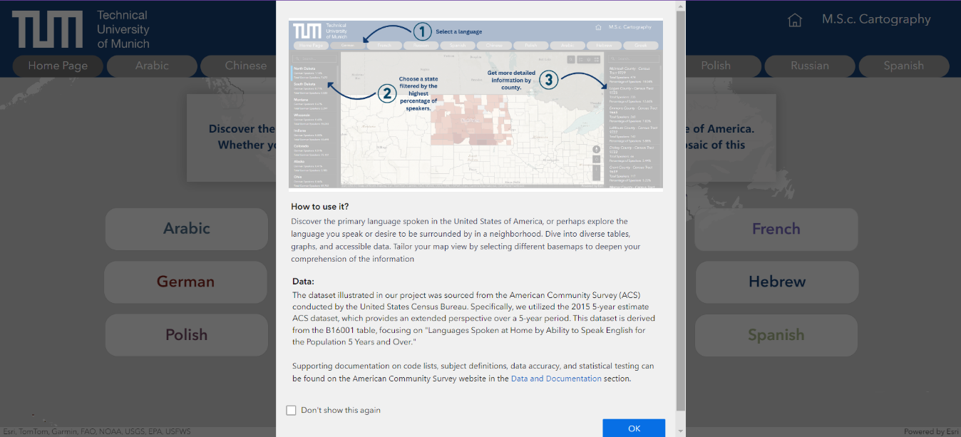
Supplementary Details and Guidance on Application Utilization.
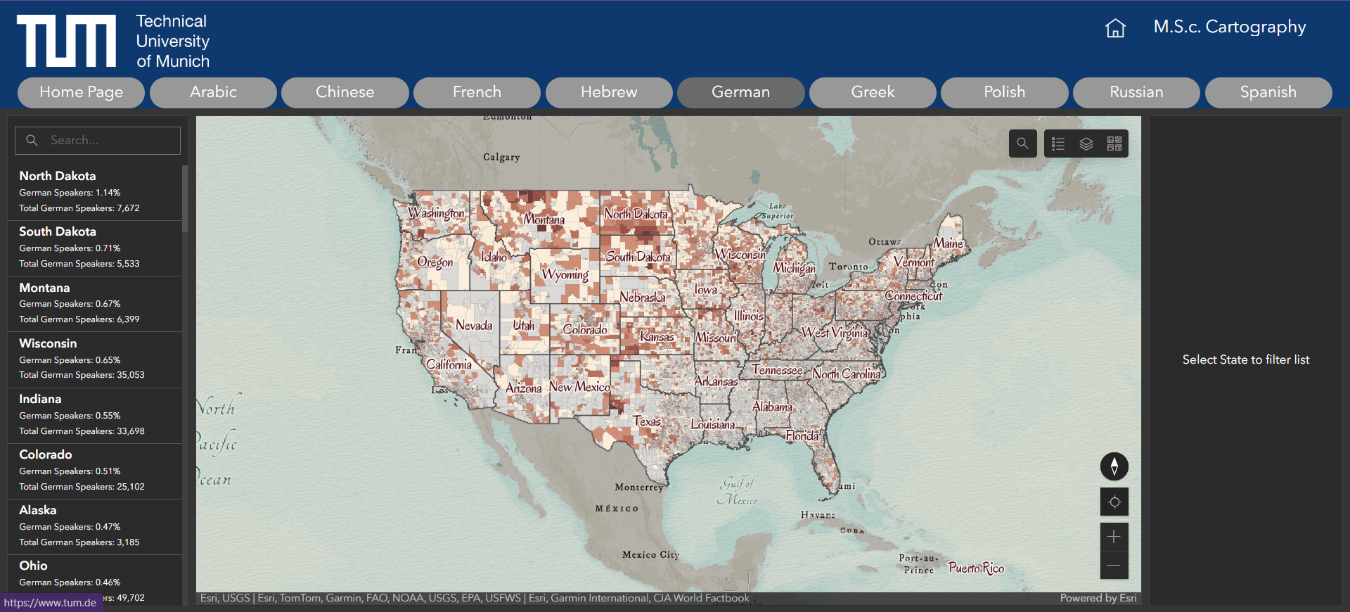
Demonstrating the Functionality of the German Web Map Dashboard.
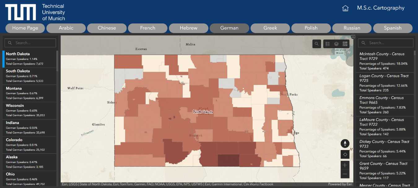
Illustration of filtered Information by State level in the German Web Map Dashboard, highlighting principal States with higher percentages of German Speakers.
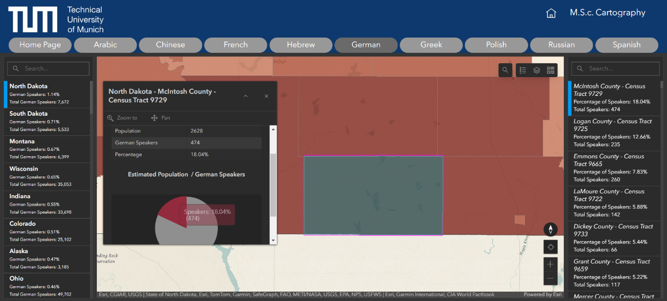
Table and percentages of filtered detailed information by Census Tract level, highlighting the Highest concentration of German Speakers across the United States.
Students
Brenda Alday
Will Curry
Will Curry
13th intake
Supervisor
Juliane Cron, M.Sc.
Keywords
Web map, languages, interactive map, us census 2015
Try it