In land-use planning, the term Urban Green Space is used to describe open-space areas that are reserved for parks and other “green spaces”. In the context of the implementation of the 17 Sustainable Development Goals (SDGs) of the United Nations that are of global concern, Urban Green Space is highly related to four of them. There is no doubt that we should pay more attention to and know more about Urban Green Space, especially its development and status.
Our project focuses on the visualization of Urban Green Space in Munich, Germany. We want to show the history and the current situation of Urban Green Space development in Munich to our audience from multiple perspectives.
Into the Green
“Discover now the Urban Green Spaces of Munich!”
Into the Green
What it is about
How we built it
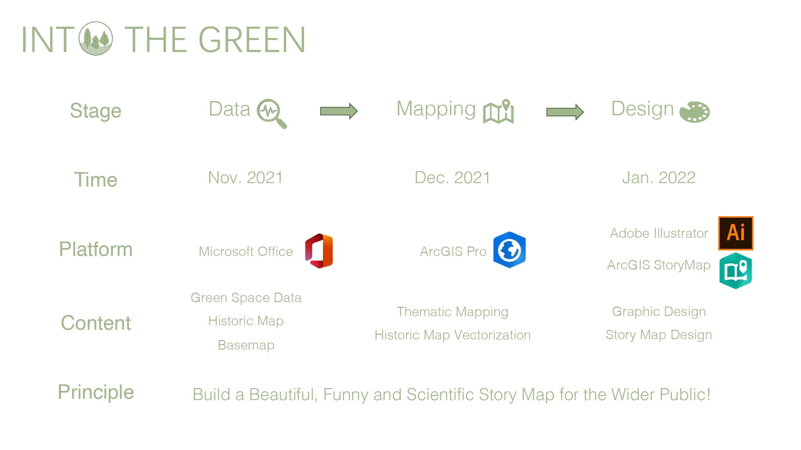
Our work can be divided into three stages, namely Data Collection Stage, Mapping Stage, and Design Optimization Stage. They all took a month separately and serve our consistent goal, which is to tell a good story about the green map of Munich.
Actually, at first, we planned to make a brochure to tell the story, then we found that a story map is really a good medium for our aim, especially when we set the target audience for this project to be the wider public. Then we just carried out our project step by step following a principle, which is to build a story map with aesthetics and fun.
Challenges we ran into
Considering the principle of our project, the main challenge was how to choose the suitable contents which can be both attractive to our target audience and possible for us to find the relevant data. Actually, getting the source data was a really big challenge for our project, and we even made a lot of vectorization work to generate historical maps.
What we're proud of
We are really proud that we finally finish the project basically following our initial plan, principle, and aim by efficient and pleasant cooperation. With pride, we can say that this story map is a beautiful, funny, and scientific introduction to the Urban Green Spaces of Munich.
What we learned
During our project, we have really learned a lot from every aspect under the supervision of Juliane and Mathias. Taking data acquisition as an example, we have tried any possible ways to get reliable data and found a lot of available ways after hard searching. How to build up a good storyline is another one.
What's next
One sentence, just go deeper. The study of urban green spaces is really interesting and meaningful because they are continuously and deeply involved in the daily life of every citizen and the development process of the city. A deeper study can be beneficial for building a more livable city.

An overview of the parks in Munich, 1900.
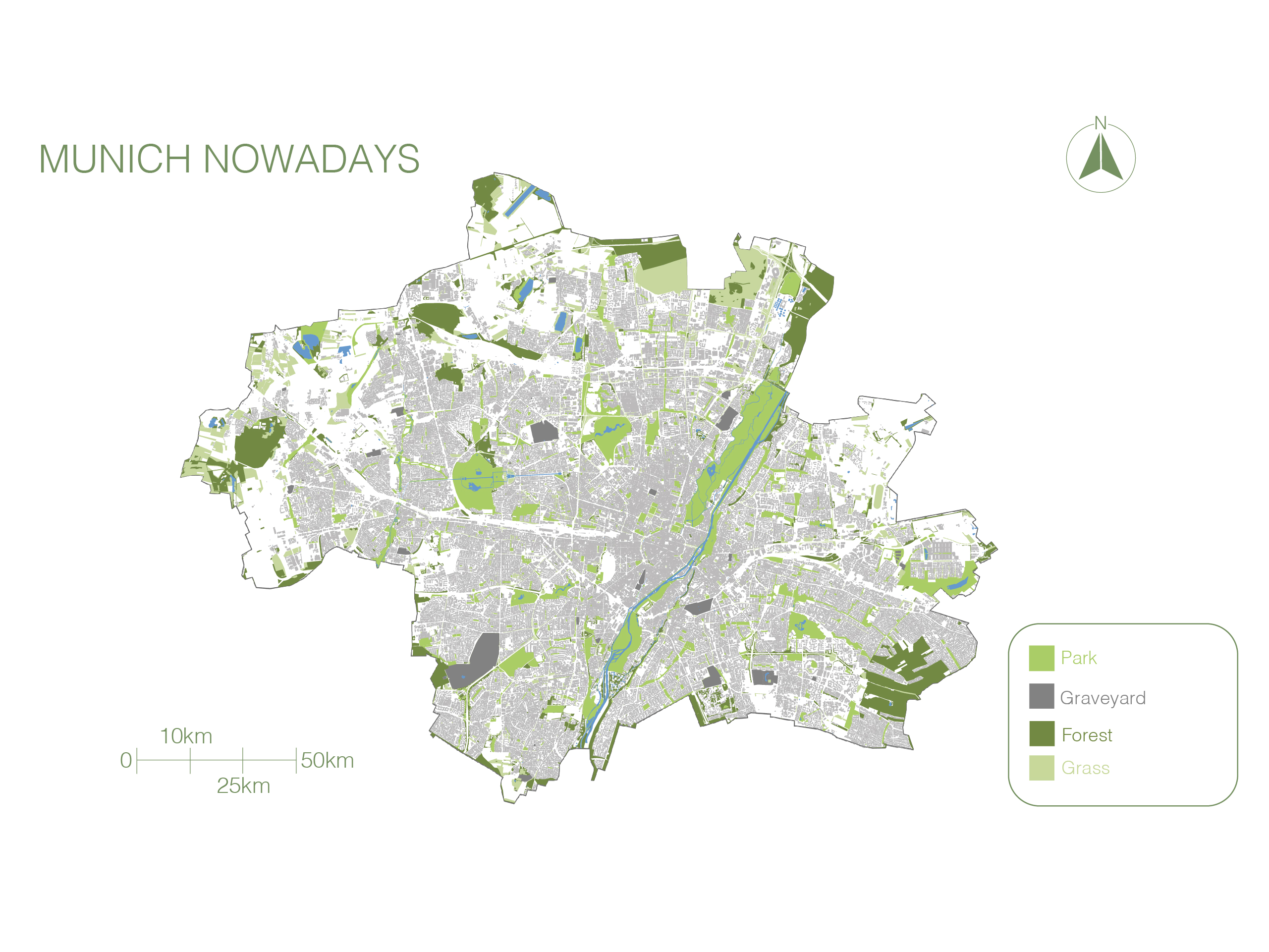
Nowadays, the situation of all open spaces in general in the city.
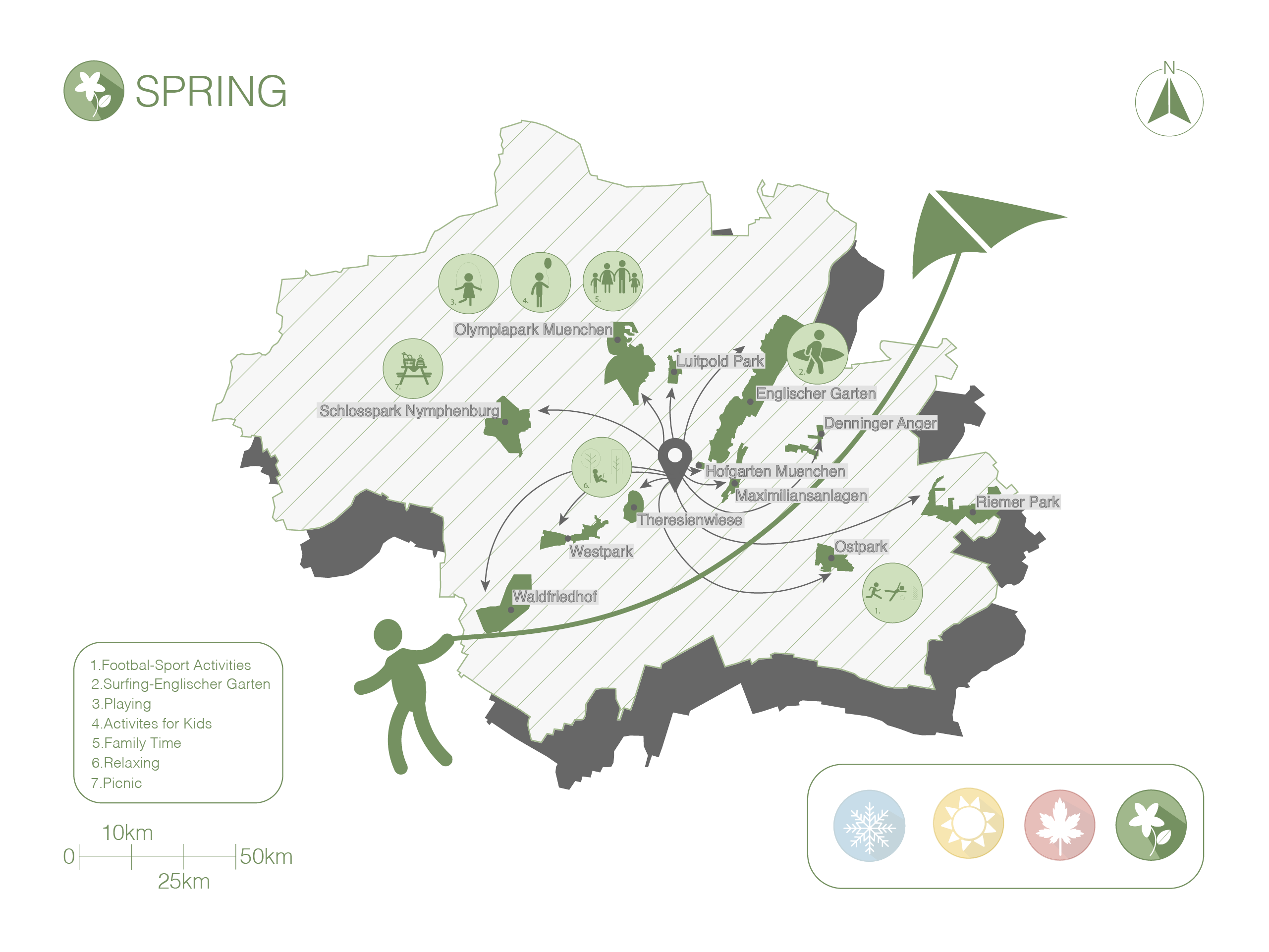
One of the fourth maps we created for the proposal in the season of Spring.
Sources
The map data used in our story map are mostly from ©️OpenStreetMap. Some of them are from the vectorization of the historical aerial images or maps, which are from the app Bayern in Historischen Karten, ArcGIS online, and Chair of Photogrammetry and Remote Sensing, TUM.
The historical and current information, and the pictures about Urban Green Spaces introduced in this story map are mostly from the Official City Portal for Munich, and some of them are from Wikipedia.
Students
Tea Muraj
Zihan Liu
Zihan Liu
11th intake
Supervisors
Juliane Cron, M.Sc.
Dr.-Ing. Mathias Jahnke
Dr.-Ing. Mathias Jahnke
Keywords
Green, Urban Green Space, Parks, Munich, Story Map, City Growth, Green Activities
Try it

